Introduction
Introduction to maritime shipping route calculation tools is a crucial aspect of the shipping industry, as it plays a significant role in determining the most efficient and safe route for vessels to travel. With the increasing complexity of global trade and the need for real-time data, the development of advanced maritime shipping route calculation tools has become essential. These tools take into account various factors, including weather conditions, sea state, and traffic patterns, to provide the most optimal route for vessels.
Importance of Real-Time Weather Variables
The inclusion of real-time weather variables in maritime shipping route calculation tools is vital, as it enables vessels to avoid adverse weather conditions, reducing the risk of accidents and minimizing delays. Weather Forecasting has become increasingly accurate, and the use of advanced meteorological models allows for the prediction of weather patterns with a high degree of accuracy. This information can be used to adjust the route of a vessel, ensuring that it avoids areas of bad weather, and arrives at its destination in the shortest possible time.
Features of Maritime Shipping Route Calculation Tools
Some of the key features of maritime shipping route calculation tools include
- Route optimization, which takes into account various factors, including fuel consumption, distance, and time
- Weather forecasting, which provides real-time data on weather conditions, including wind speed, wave height, and visibility
- Traffic management, which allows for the avoidance of congested areas and restricted zones
- Vessel performance monitoring, which provides real-time data on the vessel’s speed, heading, and position
Benefits of Advanced Maritime Shipping Route Calculation Tools
The use of advanced maritime shipping route calculation tools has numerous benefits, including increased efficiency, reduced fuel consumption, and improved safety. By taking into account real-time weather variables, these tools can help vessels to avoid adverse weather conditions, reducing the risk of accidents and minimizing delays. For more information on maritime transportation, visit the Wikipedia page on the topic. The use of advanced technologies, such as artificial intelligence and machine learning, is also becoming increasingly important in the development of maritime shipping route calculation tools, as it enables the analysis of large amounts of data and the prediction of trends and patterns.
Automated-scripts/”>Optimizing Maritime Routes with Real-Time Weather Data
Optimizing Maritime Routes with Real-Time Weather Data is crucial for the shipping industry as it enables vessels to navigate through the most efficient and safest routes. Maritime shipping route calculation tools have evolved significantly over the years, and one of the key factors that have contributed to this evolution is the incorporation of real-time weather data. These tools take into account various weather variables such as wind, waves, and currents to calculate the most optimal route for a vessel.
Introduction to Maritime Shipping Route Calculation Tools
Maritime shipping route calculation tools are software applications that use algorithms and data to determine the most efficient route for a vessel to travel from one port to another. These tools consider various factors such as distance, fuel consumption, and safety to calculate the optimal route. With the advent of real-time weather data, these tools can now factor in weather conditions to provide even more accurate and efficient route calculations. Some of the key features of these tools include:
- Route optimization based on weather conditions
- Fuel consumption reduction through optimized routing
- Safety enhancements through avoidance of severe weather conditions
- Real-time updates on weather conditions and route adjustments
Benefits of Real-Time Weather Data in Maritime Shipping Route Calculation
The incorporation of real-time weather data in maritime shipping route calculation tools has numerous benefits. Some of the key benefits include:
- Improved safety through avoidance of severe weather conditions
- Reduced fuel consumption through optimized routing
- Increased efficiency through reduced voyage times
- Enhanced cargo protection through reduced exposure to severe weather conditions
These benefits can be achieved through the use of advanced weather forecasting models and real-time data from weather stations, satellites, and other sources.
Implementation and Future Developments
The implementation of maritime shipping route calculation tools that factor in real-time weather variables requires significant investment in technology and infrastructure. However, the benefits of these tools far outweigh the costs, and many shipping companies are already adopting these tools to optimize their maritime operations. Future developments in this area are expected to include the integration of artificial intelligence and machine learning algorithms to further improve the accuracy and efficiency of these tools. Additionally, the use of internet of things (IoT) devices and big data analytics is expected to play a significant role in the development of these tools. With the continued advancement of technology, we can expect to see even more sophisticated maritime shipping route calculation tools that can optimize maritime routes in real-time based on weather and other factors.
Advanced Weather Integration in Shipping Route Calculation
Advanced Weather Integration in Shipping Route Calculation is a crucial aspect of maritime shipping, as it enables vessels to navigate through the most efficient and safest routes possible. With the advent of technology, shipping route calculation tools have become increasingly sophisticated, factoring in real-time weather variables to minimize risks and optimize journey times.
Introduction to Real-Time Weather Integration
The integration of real-time weather data into shipping route calculation tools has revolutionized the maritime industry. These tools utilize advanced algorithms and machine learning models to analyze vast amounts of weather data, including wind patterns, wave heights, and ocean currents. By considering these factors, vessels can avoid adverse weather conditions, reduce fuel consumption, and lower their environmental impact. Some of the key features of these tools include:
- Weather forecasting: providing accurate and up-to-date weather forecasts to inform route planning decisions
- Route optimization: identifying the most efficient routes based on real-time weather data and other factors such as traffic and sea state
- Risk assessment: evaluating the potential risks associated with different routes and providing recommendations for mitigation strategies
Benefits of Advanced Weather Integration
The benefits of advanced weather integration in shipping route calculation are numerous. By factoring in real-time weather variables, vessels can:
- Reduce their fuel consumption by up to 10%, resulting in significant cost savings and a lower carbon footprint
- Minimize their downtime due to adverse weather conditions, ensuring timely delivery of goods and improved supply chain reliability
- Improve crew safety by avoiding severe weather conditions and reducing the risk of accidents and injuries
- Enhance their competitive advantage by optimizing their routes and reducing their transit times
Future Developments in Weather Integration
As technology continues to evolve, we can expect to see even more sophisticated weather integration in shipping route calculation tools. Some potential future developments include:
- Increased use of satellite data to provide more accurate and detailed weather forecasts
- Integration with other data sources, such as ais data and sensor data, to provide a more comprehensive picture of weather conditions
- Development of more advanced algorithms and machine learning models to improve the accuracy and reliability of weather forecasts and route optimization recommendations. By leveraging these cutting-edge technologies, the maritime industry can continue to improve its efficiency, safety, and environmental sustainability. Advanced weather integration is set to play a critical role in shaping the future of maritime shipping, enabling vessels to navigate the world’s oceans with greater precision, reliability, and responsibility.
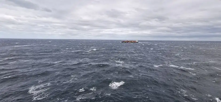
Real-Time Weather Variables in Maritime Route Optimization
Maritime shipping route calculation tools have become increasingly sophisticated in recent years, with many now factoring in real-time weather variables to optimize route planning. This is a significant development, as weather conditions can have a major impact on the safety and efficiency of maritime shipping operations. By taking into account current weather patterns and forecasted weather conditions, shipping companies can reduce their exposure to weather-related risks and minimize delays.
Introduction to Real-Time Weather Variables
The use of real-time weather data in maritime route optimization is a key factor in reducing fuel consumption and emissions, as well as improving safety. By analyzing current weather conditions and forecasted weather patterns, shipping companies can identify the most efficient route and make adjustments as needed to avoid adverse weather conditions. Some of the key real-time weather variables that are factored into maritime route optimization include:
- Wind speed and direction
- Wave height and period
- Sea state and ocean currents
- Precipitation and visibility
Benefits of Real-Time Weather Variables in Route Optimization
The benefits of using real-time weather variables in maritime route optimization are numerous. Some of the key advantages include:
- Improved safety by avoiding adverse weather conditions
- Reduced fuel consumption and emissions through more efficient routing
- Minimized delays and disruptions to shipping operations
- Enhanced cargo protection by reducing the risk of damage or loss due to weather-related events. For more information on the impact of weather conditions on maritime shipping, visit the Wikipedia page on maritime transport.
Implementing Real-Time Weather Variables in Route Optimization
The implementation of real-time weather variables in maritime route optimization requires the use of advanced technology and sophisticated algorithms. Shipping companies must invest in weather data services and route optimization software that can analyze real-time weather data and provide accurate and reliable route recommendations. By doing so, they can stay ahead of the competition and maintain a competitive edge in the maritime shipping industry, while also reducing their environmental impact through more efficient operations and reduced emissions. Weather forecasting and route optimization are critical components of maritime shipping operations, and the use of real-time weather variables is becoming increasingly important for shipping companies that want to stay safe, efficient, and competitive.
Dynamic Route Calculation for Safe and Efficient Maritime Shipping
Dynamic Route Calculation for Safe and Efficient Maritime Shipping is a critical aspect of the maritime industry, as it directly impacts the safety of crew, cargo, and vessel, as well as the overall efficiency of the shipping operation. One of the key factors that affect maritime shipping route calculation is weather, which can be unpredictable and potentially hazardous. To mitigate these risks, maritime shipping route calculation tools have been developed to factor in real-time weather variables, ensuring that ships take the safest and most efficient route possible.
Introduction to Real-Time Weather Variables
Maritime shipping route calculation tools that incorporate real-time weather variables can significantly improve the safety and efficiency of shipping operations. These tools use satellite imagery, radar technology, and other meteorological data to provide accurate and up-to-date weather forecasts. By analyzing this data, ships can adjust their routes to avoid storms, hurricanes, and other severe weather conditions that could pose a threat to the vessel and its cargo. Some of the key features of these tools include:
- Real-time weather updates and forecasts
- Route optimization to minimize fuel consumption and reduce emissions
- Risk assessment and mitigation strategies to ensure safe navigation
- Alert systems to notify crew and shore-based personnel of potential weather hazards
Benefits of Real-Time Weather Variables in Route Calculation
The benefits of using maritime shipping route calculation tools that factor in real-time weather variables are numerous. These tools can help reduce the risk of accidents and injuries by avoiding hazardous weather conditions. They can also improve the overall efficiency of shipping operations by optimizing routes and reducing fuel consumption. Additionally, these tools can help ships comply with regulatory requirements and reduce their environmental impact. Some of the other benefits include:
- Improved safety and reduced risk of accidents
- Increased efficiency and reduced fuel consumption
- Enhanced compliance with regulatory requirements
- Reduced emissions and environmental impact
Implementation and Future Developments
The implementation of maritime shipping route calculation tools that incorporate real-time weather variables is becoming increasingly widespread. As technology continues to advance, we can expect to see even more sophisticated tools and systems being developed. Some potential future developments include the integration of artificial intelligence and machine learning algorithms to improve route optimization and weather forecasting. Additionally, the use of Internet of Things (IoT) devices and sensor technology could provide even more accurate and detailed weather data, further enhancing the safety and efficiency of maritime shipping operations. By embracing these technological advancements, the maritime industry can continue to improve the safety and efficiency of shipping operations, while also reducing its environmental impact.
Integrating Real-Time Weather Forecasting in Maritime Shipping Route Planning
Integrating real-time weather forecasting in maritime shipping route planning is crucial for ensuring safe and efficient navigation. Maritime shipping route calculation tools play a vital role in this process, as they help determine the most optimal route for a vessel based on various factors, including weather conditions. These tools use complex algorithms and data analytics to analyze various weather variables, such as wind speed, wave height, and sea state, to provide accurate and reliable route calculations.
Current State of Maritime Shipping Route Calculation Tools
Maritime shipping route calculation tools have evolved significantly over the years, with many now incorporating real-time weather forecasting and historical weather data to provide more accurate route calculations. These tools use advanced algorithms and machine learning techniques to analyze large amounts of weather data, including satellite imagery and weather forecasts from various sources. Some of the key features of these tools include:
- Route optimization: calculating the most fuel-efficient and time-effective route based on weather conditions and other factors
- Weather forecasting: providing real-time weather forecasts and warnings to help vessels avoid severe weather conditions
- Vessel performance monitoring: tracking a vessel’s speed, course, and fuel consumption in real-time to optimize route calculations
Incorporating Real-Time Weather Variables
Incorporating real-time weather variables into maritime shipping route calculation tools is essential for ensuring safe and efficient navigation. Some of the key weather variables that are factored into these tools include:
- Wind speed and direction: affecting a vessel’s speed and course
- Wave height and period: impacting a vessel’s stability and comfort
- Sea state: influencing a vessel’s speed and maneuverability
- Weather forecasts: providing predictions of weather conditions along a vessel’s route
Future Developments in Maritime Shipping Route Calculation Tools
The future of maritime shipping route calculation tools looks promising, with advances in technology and data analytics expected to play a major role in shaping the industry. Some of the key developments that are expected to impact the industry include:
- Increased use of artificial intelligence and machine learning to improve route calculations and weather forecasting
- Greater emphasis on sustainability and environmental factors, such as fuel efficiency and emissions reduction
- More accurate and reliable weather forecasting, using advanced weather models and satellite imagery. By incorporating real-time weather forecasting and advanced data analytics, maritime shipping route calculation tools can help vessels navigate safely and efficiently, while also reducing fuel consumption and emissions. As the industry continues to evolve, it is likely that maritime shipping route calculation tools will play an increasingly important role in shaping the future of global trade and maritime transportation.
Conclusion
In conclusion, the development and implementation of maritime shipping route calculation tools that factor in real-time weather variables have revolutionized the shipping industry. These tools have enabled ship owners, operators, and charterers to optimize their routes, reducing fuel consumption, emissions, and operational costs. The integration of real-time weather forecasting and ocean currents data has allowed for more accurate and efficient route planning, resulting in significant benefits for the industry.
The Importance of Real-Time Data
The use of real-time weather data and ocean currents is crucial in maritime shipping route calculation. This data enables ship owners and operators to make informed decisions about route planning, taking into account wind, waves, and currents. Some of the key features of these tools include:
- Real-time weather forecasting and ocean currents data
- Route optimization based on fuel consumption and emissions
- Alert systems for weather-related hazards and sea state
- Integration with existing navigation systems
By utilizing these features, ship owners and operators can reduce their environmental impact while also improving the safety and efficiency of their operations.
Benefits and Future Developments
The benefits of using maritime shipping route calculation tools that factor in real-time weather variables are numerous. Some of the key benefits include:
- Reduced fuel consumption and emissions
- Improved safety and efficiency of operations
- Enhanced route optimization and planning
- Increased compliance with regulations and standards
As the industry continues to evolve, we can expect to see further developments in maritime technology, including the integration of artificial intelligence and machine learning. These advancements will enable even more accurate and efficient route planning, resulting in significant benefits for the industry and the environment.
Future of Maritime Shipping
The future of maritime shipping will be shaped by the development and implementation of sustainable and efficient technologies. The use of maritime shipping route calculation tools that factor in real-time weather variables will play a critical role in this process. By reducing fuel consumption and emissions, these tools will help the industry to meet its environmental obligations while also improving the safety and efficiency of operations. As the industry continues to evolve, it is essential that ship owners, operators, and charterers stay up-to-date with the latest developments in maritime technology, including real-time weather forecasting and route optimization. By doing so, they can ensure that their operations are sustainable, efficient, and compliant with regulations and standards.
Frequently Asked Questions
What are maritime shipping route calculation tools?
Maritime shipping route calculation tools are software applications designed to determine the most efficient and safe routes for ships to travel, taking into account various factors such as weather, sea state, and vessel characteristics.
How do these tools incorporate real-time weather variables?
These tools use real-time weather data, such as
- Wind speed and direction
- Wave height and period
- Sea surface temperature
- Atmospheric pressure
to calculate the optimal route, minimizing the impact of adverse weather conditions on the voyage.
What are the benefits of using maritime shipping route calculation tools with real-time weather variables?
The benefits include
- Improved safety by avoiding hazardous weather conditions
- Reduced fuel consumption and lower emissions
- Increased efficiency and reduced transit times
- Enhanced vessel performance and reduced wear and tear
- Better planning and decision-making for ship owners and operators
Can these tools be integrated with other ship systems and technologies?
Yes, maritime shipping route calculation tools can be integrated with
- Electronic Chart Display and Information Systems (ECDIS)
- Automatic Identification Systems (AIS)
- Weather forecasting systems
- Vessel performance monitoring systems
- Other ship systems and technologies to provide a comprehensive and integrated solution.
How often are the weather variables updated in these tools?
The frequency of updates varies depending on the tool and the source of the weather data, but typical update intervals range from:
- 1-3 hours for satellite-based weather data
- 15-60 minutes for buoy-based weather data
- Real-time updates for radar-based weather data
- Continuous updates for model-based weather forecasts, which are updated as new data becomes available.